Bill Hanson – Nature Photographer
Gallery
Shows and Exhibits
Alaska
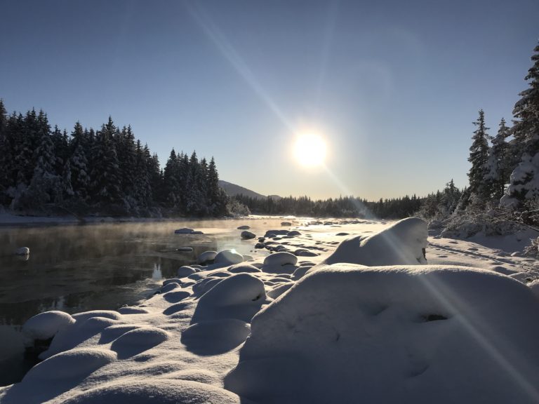
Fog rises as the Mendenhall River flows out of Mendenhall Lake
Skiing Mendenhall Lake to Mendenhall River
Alaska Garden Box Beds-Moving for Winter
Nellie the Sheltie-Dog of the North Woods
Southeast Alaska Sunrise-Mt. Juneau towers over Douglas Bridge
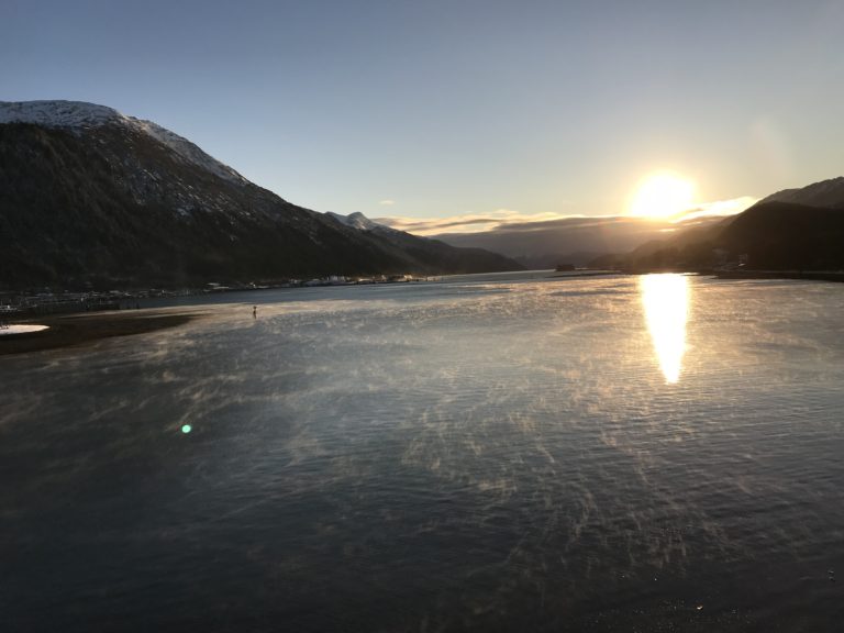
Winter Sunrise: Gossamer cobwebs of fog rise from Gastineau Channel
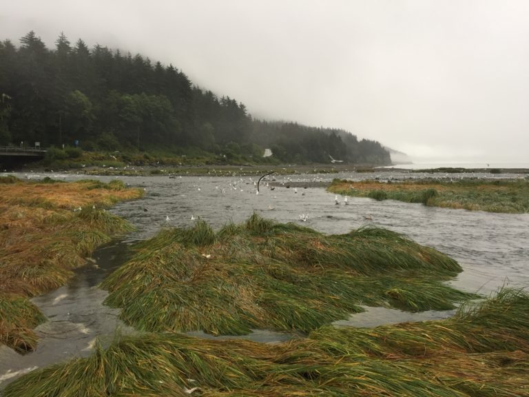
Spawning Salmon Feed Birds, Animals, and Trees
Pocket Parks: Habitat Diversity in New York City
Southeast Alaska’s Gastineau Channel: Can you see the cruise ship?
Alaska Halibut Fishing Welcomes Me Home
4
1
2
5
No results found.
Recent Posts
Spice Café & Gallery
Rarefied Light 2024
Alaska-Yukon Road Trip: Lake Laberge & Advice from Raven
Categories
About the Alaska Billy Blog
Alaska
Alaska Fish & Wildlife
Ecology
Events and Shows
India Explorations
Juneau
Landscapes
Life on the Ranch
Road Trips
Southeast Alaska Life
Southeast Alaska Saltwater
The Spirituality of Landscape
Translating Past to Present
Travels in Alaska
Follow Bill Hanson
Tags
adventure
(9)
Alaska
(22)
alaskanadventure
(3)
bears
(2)
black bear
(2)
boating
(2)
bridges
(2)
brown
(2)
companion
(1)
cross country skiing
(2)
ecology
(7)
estuary
(2)
explore
(9)
fish
(2)
fishing
(5)
Garden
(1)
glacier
(6)
gulls
(2)
habitat
(4)
hiking
(4)
hiking hike
(2)
Himalaya
(1)
Juneau
(15)
landscape
(17)
Mendenhall
(4)
mountain
(4)
nature
(13)
pet
(1)
photography
(2)
pnw
(4)
rainforest
(5)
reflections
(6)
salmon
(2)
saltwater
(3)
skiing
(2)
Southeast Alaska
(7)
southeastalaska
(7)
spawning
(2)
subsistence
(2)
sunrise
(2)
urban gardening
(1)
wild
(2)
wilderness
(7)
wildlife
(7)
winter
(2)